Anywho, I don't remember exactly how we heard about the place we went next. I think maybe a tour guide somewhere mentioned it? Or maybe we saw a sign? It's hard to say. In any case, our first stop of the day was the Carrowmore Megalithic Cemetery. The tombs date from about 4000-3500 BC, when farmers first settled in the area. I guess before that, when the people were more nomadic, they didn't really have burial traditions that we know about. Carrowmore is a group of passage tombs (basically a burial chamber or chambers covered by rocks and/or dirt with a stone passage leading to the inside. I think the idea is that many people could be buried in one tomb) in various stages of disrepair. Some of the tombs, especially the big one in the middle, have been reconstructed to what archeologists think they would have been like, others are still just ruins, and still others were basically destroyed by farmers stealing the rocks for fences and stuff thousands of years after the original burials, probably in the 1800s. The site itself is actually right in the middle of a bunch of farms. Probably the best preserved tomb that we saw was actually in the middle of a cow pasture. There are apparently about 30 tombs in this site, although there definitely aren't that many visible. There are also at least 3 other major sites for passage tombs, but Carrowmore is considered the main one. It was really interesting, but definitely the kind of place that would have benefited from a tour guide. We spent a lot of time looking at our map and trying to figure out if these rocks on the ground were part of a tomb, and if so, which one? And I'm not completely convinced that I understand all the significance of the site. Plus, I like tour guides! Still, it was worth a visit.

One of the tombs. This one was pretty well preserved in that it still had a lot of rocks. Some of them were only like 1 rock sticking out of the ground.

This tomb is, as you can see, in a cow pasture. It's not technically part of the historic site, but according to the info we got, this is one of the best preserved of the tombs. Kind of weird that it's just on a farm.

The main tomb on the site, which has been restored by archeologists to what they think it would have looked like then. Pretty different from the other ruins, but this one is also significantly bigger than the other tombs.

At the entrance of the main tomb, called Listoghil. As you can see, it's really big, and when it was excavated, they found bones of a lot of people and animals.

Knocknarea Mountain, which overlooks Carrowmore. Apparently, there's a large mound at the summit of the mountain named for Queen Maeve. It's not excavated, but they're pretty sure it's another passage tomb. We didn't get to go up, alas.
After we left Carrowmore, we crossed over into Northern Ireland for our trip to Belleek Pottery. Niki and I went there on our trip, but little did we realize, you can't take the tour on weekends. So Leah and I made sure our trip would be on a day that we could do the tour. It was actually some sort of bank holiday, so there were only a few workers, but it was still a really neat tour. One thing that's really neat about Belleek vs. somewhere like Waterford is that all of the pieces you can buy are actually made on site, whereas at Waterford, most of the non-specialized stuff is made elsewhere in Europe. So when you buy something from their store, you know that it was made only a few feet away. Pretty much everything is done by hand, including all of the painting. The pieces like vases and stuff are done in molds, of course, to keep them uniform. Belleek is very famous for their shamrock pottery as well as their woven baskets. The baskets are entirely handmade. We saw workers doing the weaving and making the tiny decorations. Very impressive, and it explains why the stuff is so expensive! If you ever go, definitely check the website in advance to make sure you can take the tour.

Belleek! The showroom and restaurant are in the front, and there's a museum and the factory out back.

Some of the different pottery pieces in an early stage. These are made with molds, but each is checked and smoothed by hand before they go through the painting and glazing process.

The beginnings of a basket and a bunch of decorative pieces. These are all done by hand.

Here you can see one of the artists building a basket piece by piece.

One of the artists adding shamrocks to the pieces.
Our last stop of the day were the Sliabh Liag cliffs (I could not swear to the pronunciation of that, but I want to say is the bh makes a v sound). Technically Sliabh Liag is about 3 times higher than the Cliffs of Moher, although it's not nearly as famous. I'd say probably because the landscape is very different, more mountain than sheer cliffs, although it's still really impressive. We parked at the bottom of this trail and hiked up, mostly because it seemed like you weren't supposed to drive (a common theme of our trip). I'm glad we did hike, because it was a beautiful day, and we got to see the scenery a lot better on foot than we could have from the car. But apparently it was a weird choice, because more than one car that passed us on the way down offered us a ride. I don't remember how long we walked (maybe an hour each way?) but at the point were we stopped to turn around, there was another trail leading up into the mountains. If you are a keen hiker, this would be an excellent place to visit. If it hadn't been getting late in the evening, we might have gone further ourselves.

On the hike up Sliabh Liag. It was very windy and a little wet, but that's perfect hiking weather in my opinion.

When we finally reached the part of the hike that's on the edge of the cliff.

That small square sticking up off the edge of the cliff is a signal tower. It's one of many that were built along the coast in about 1800 to warn if Napoleon was trying to invade.

In between the two weirdos here are some stairs leading further up the mountain. We were imagining how tired we would be if we kept going.

It may not have quite the dramatic coastline that The Cliffs of Moher do, but tis still a spectacular view.
If I recall correctly, and I might not, since it's been an actual year since this trip, the next two nights of our trip we stayed at a place that was pretty much impossible to find. We almost despaired before we figured out the directions. And then it said there was a regular bed and a pull out couch, but there was not room for the couch to pull out! So we just gave in and shared. There were chocolate bars there for us, though. So that was nice.
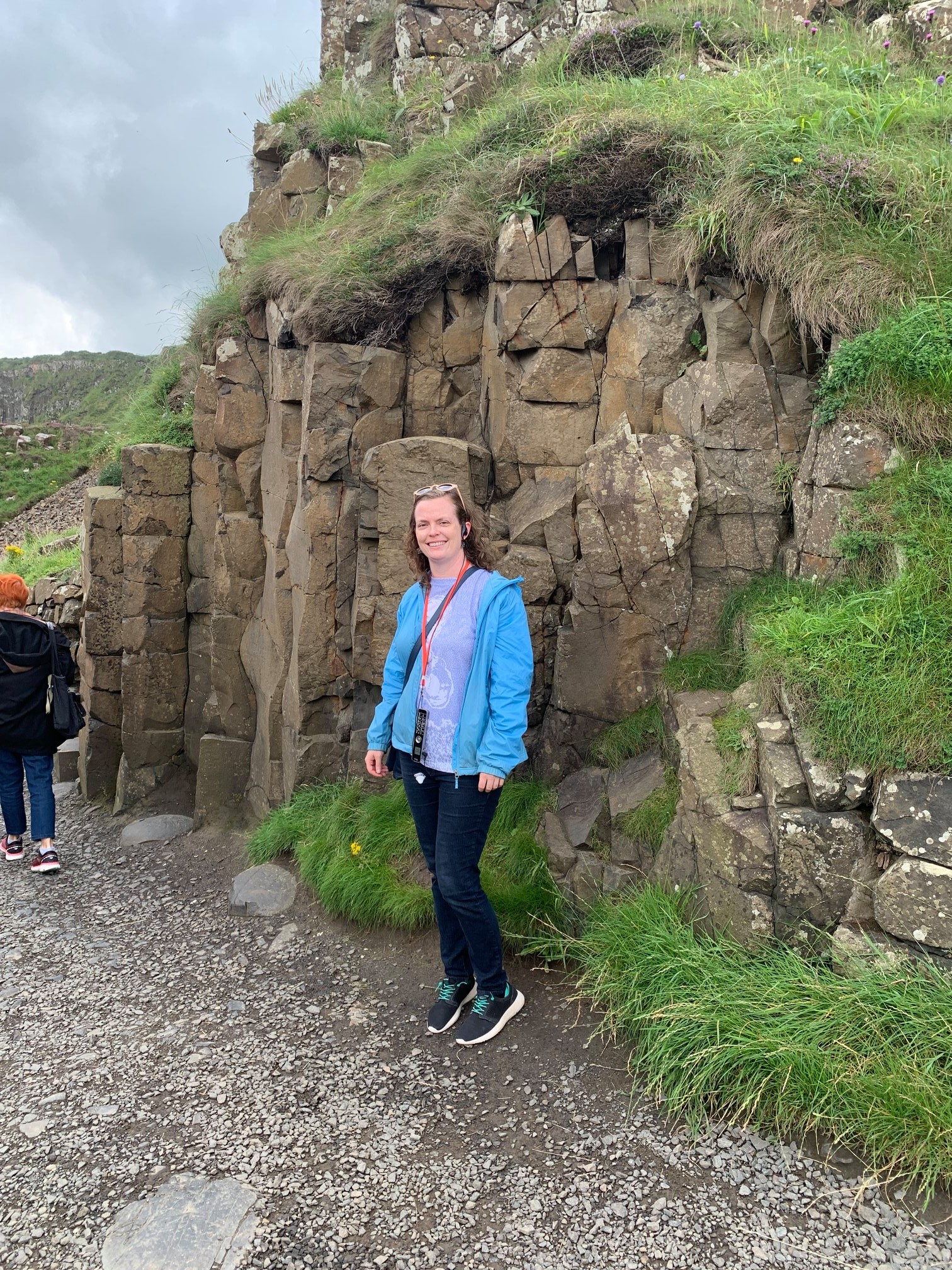
The next day, we were back into Northern Ireland. First stop, Giant's Causeway! This was another place I had previously been, but seriously, I don't care how many times you go to Ireland, you have to go to Giant's Causeway. It's amazing. And the weather could not have been more different. When Niki and I went, it was pouring rain, so we stayed on the main path and were just wet. But this day was beautiful, so Leah and I were able to hike around and see a bunch of cool stuff. Giant's Causeway is a real geological marvel. It truly doesn't look like something nature could make on its own, which is probably why there are many legends about how it was formed by actual giants messing around in the sea between Ireland and Scotland. There's a corresponding site in Scotland, which I have not been to, but the one in Ireland is home to Fionn mac Cumhaill (English-Finn MacCool), and a lot of the cool features are part of his house/his camel/his grandma, etc. The actual geology has to do with volcanic activity forming basalt columns, but that's not as fun. One of the great things about the Causeway is the audio tour you can get at the visitor's center. Technically, you can go to the site for free, but if you enter through the center for a totally reasonable fee, you get the tour with tons of cool info about the legends, the geology, and the history of people who used to work and live there.

The pillars here really look manmade. Science and nature are wonderful!
I cannot remember what this is called, but it's some sort of Giant's doorway or something.

The worst part about going on a day when the weather was nice were the huge amounts of people. When Niki and I went in the heavy rain, there were hardly any people. All of those little specks in the background are other tourists, ruining our pictures.

The Giant's Organ over to the left. Supposedly you can hear it playing on Christmas morning. You can also see the path that we hiked leading up to it and to the top of the cliff.

At the organ. You can see how ginormous it really is now that I'm right next to it.

The path dead-ends beyond that doorway, and then you have to backtrack to go up to the top. I believe those little spires are the Giant's Chimney.

We went past the doorway because we could, but we had to turn back almost immediately.

But we did have this nice view of someone sailing!

We made it to the top! There were some extremely steep stairs on the path to get up there.

Obviously near the end of our hike when I am very sweaty. You can see the whole Causeway behind me, including the chimney. The part sticking out to the left is where the Scottish giant, Benandonner, broke up the causeway between the two countries when he fled back across the sea because he was so scared of Fionn.
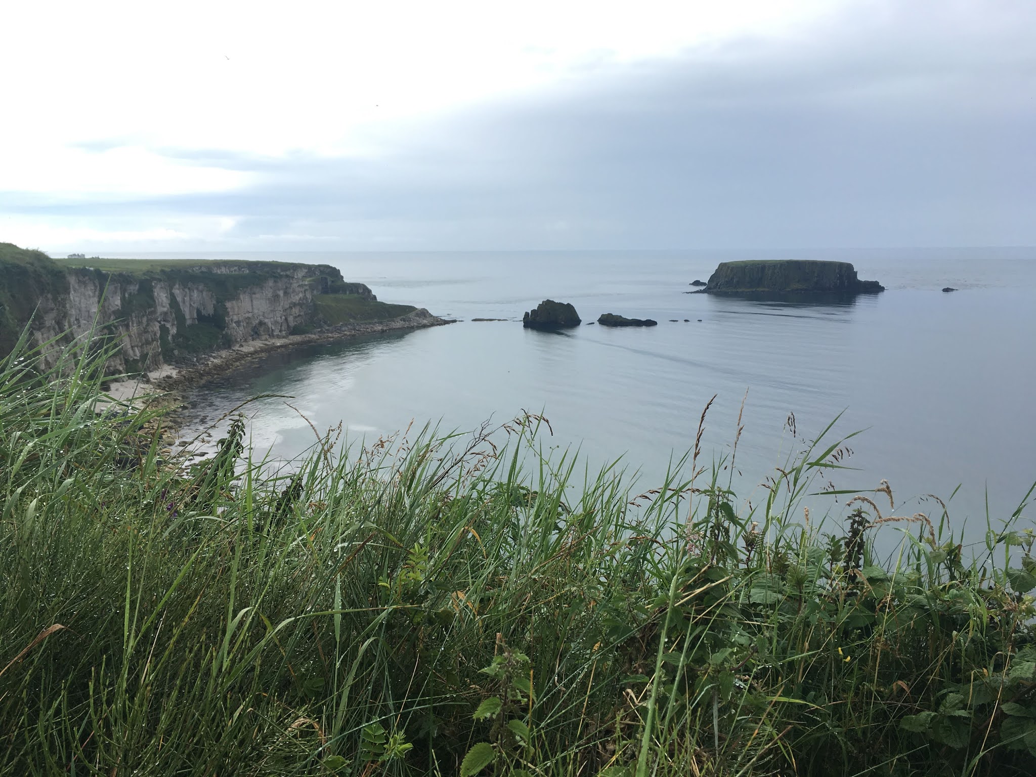
When we left Giant's Causeway, we headed for Carrick-a-Rede, also in Northern Ireland, and a place that Leah really wanted to go. Me, not so much, so for the first and only time on our trip, we split up a bit. Carrick-a-Rede is a small island off the coast that used to be home to salmon fishermen, although it's really too small for people to live there permanently. Instead, the fishermen, who normally lived on the mainland, would stay on the island for part of the year while catching the fish and taking them to the mainland. Due to the geography, it was a lot easier and more efficient for the people to cross back and forth along a rope bridge. The historical rope bridge was a ladder that the people would string between the two pieces of land, along with one rope for a hand rail. Only one hand rail, because they needed their other hand free to carry all the fish back over. And truly, it was a ladder, so not wide at all. They would take it down every winter and store it, and presumably give it some maintenance, but still. Absolutely terrifying. After my experience with the tower at St. Canice's, I decided that I wasn't going to cross the bridge, but instead would just hang out on the mainland while Leah went. She did pay extra for a tour guide, and he very kindly invited me to go along with and learn about the area, since he doesn't cross the bridge either. I'm glad I went, it was super interesting. According to him, there's a good chance that none of the fishermen knew how to swim at all, but also, as he said, if they fell off the bridge, they probably would have just died, even if they knew how, so it didn't really matter. The bridge now, is much more sturdy, much to Leah's dismay, I think. She wanted it to sway a bunch. Based on what she said when she got back, I might have even been OK.

You can see how small the actual island is. There's one small cottage on it, which is the white spot you can sort of see near the middle of the picture. And there's the bridge!

Leah crossing the bridge! She's the one in the white jacket.

The view from the bridge. Look how crazy clear the water is.

Crossing the bridge. Maybe I was wrong. This looks terrifying! This is Leah, btw. I stayed on the mainland!
Other things our guide told us on the way-fishing is no longer allowed in the area. In peak times, they would catch about 300 salmon a day around the island, but in 2002, the last year fishing was allowed, they only caught 300 fish the whole year. So now fishing isn't allowed anymore in the hopes that the salmon population will eventually recover. Of course, them fishing isn't the only thing that hurt the salmon, so who knows. We also learned about the mining that took place in the area. If I recall correctly, there were two different kinds of mining done in the area-one was stopped during WWI, since all of the Welsh miners left to go to war. The other kind was abandoned during The Troubles due to safety concerns and never started up again. It was interesting and sobering to hear about The Troubles from someone who had lived through them. Something else we learned-a bunch of stuff from Game of Thrones was filmed here! Apparently the show really made a lot of people interested in the site, and now it's a popular tourist destination, whereas before, it was not a well known site at all.

Look at that water. Can you imagine what it must have looked like when huge schools of salmon were swarming around the coast every year?

The parking lot, but also where some important GoT scenes were filmed. Our rental is the blue car about six cars down.

Also a GoT filming site, although inside. I think this was some sort of mine building? I don't remember.
I think also at this site (although Leah will correct me if she remembers differently), we learned some about the potato famine. If you don't really know anything about it, it's a really dark, horrible chapter of history, in which rich land owners and the British government let Irish people starve because the only crops they were allowed to keep was potatoes, and the potatoes were dying. I think we hear more about the famine as "They only grew potatoes, and they failed," but that's definitely not true. Ireland was exporting huge amounts of food during the famine. We had a view of a pretty large island further off the coast that lost almost all of its population during the famine due to death and immigration. People now estimate that about 1 million people died from the famine and another million immigrated, which means that the country lost almost 1/4 of its population. Some places, including this island that we saw, have never recovered to their pre-famine populations.

Unless I'm totally mistaken, that island in the distance is the one our guide told us about that lost most of its population during the famine.
My view as I hiked away from Carrick-a-Rede to explore on my own.

Looking back towards the rope bridge. I think it's in the upper right hand corner of the picture.

With the rope bridge and island in the background. It was an amazingly beautiful place, even without crossing the bridge.
As you can see, the tour was really educational! He even told us stuff about local farming practices. This is why it's a good idea to get a tour guide when you can. I left Leah at the bridge, and she went to explore the tiny island, while I hiked back and looked around on the mainland. I had a great time and saw some really wonderful views, even without having to cross the scary bridge. So I think it was the right decision for me. If you don't have a fear of heights, I'd recommend the bridge, though.
Next time, on The Black Lung: We eat some chocolate (yay!) and have to go home (boo!).